Forth and Clyde Canal Exploring Edinburgh - Glasgow Canals

 Scottish Towns

  Galston
Scotland - Lonely Planet Rough Guide Scotland

Photographs of the town of Galston

 on the River Irvine in Ayrshire

 in SW Scotland

"Wee Train" pub in Galston

"Wee Train" pub in Galston

Galston is situated in wooded countryside
 some 4 miles up-river from 
Kilmarnock
and is one of the small towns in the 
Irvine Valley
 lying between the towns of 
Hurlford and Newmilns.

To the north of the town
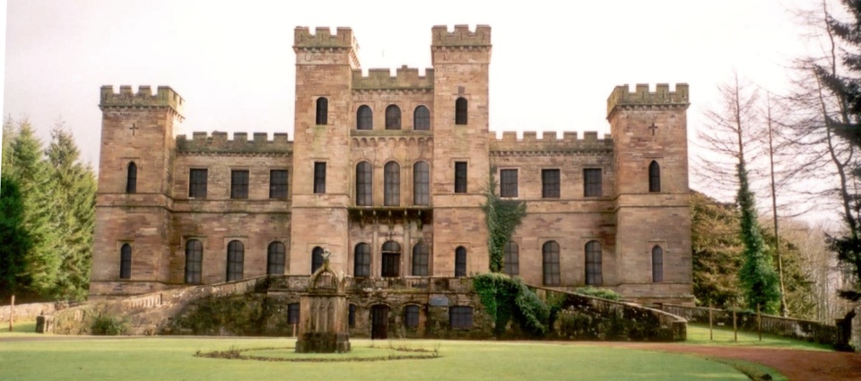
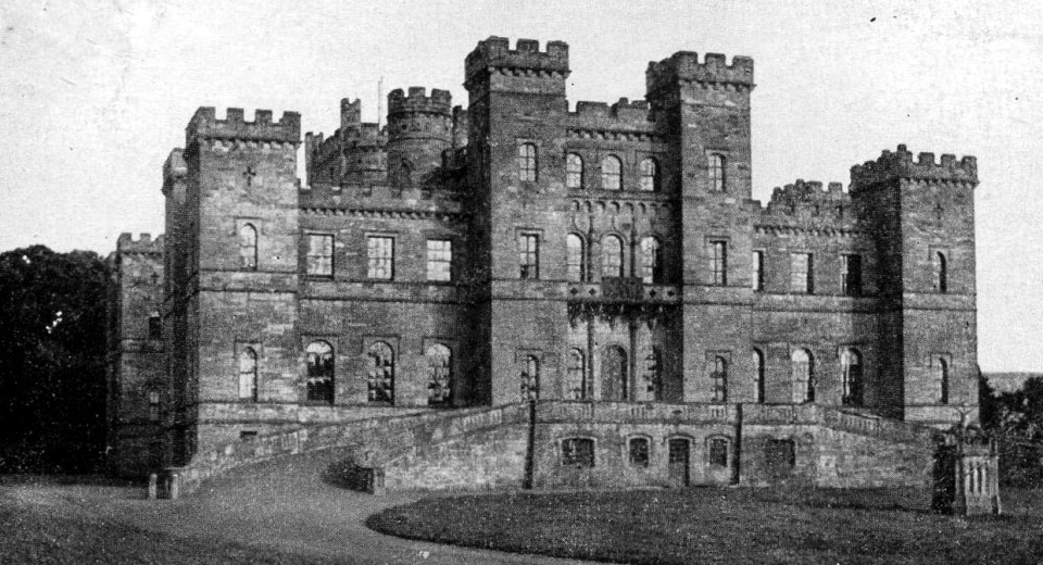
 is the ruin of 
Loudoun Castle.


St Sophia Church in Galston

St Sophia Church in Galston

built in 1884/86
 in Byzantine style
 based on the Hagia Sophia in Istanbul


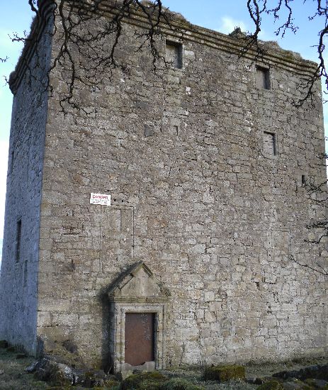
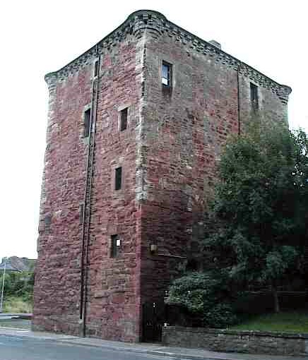
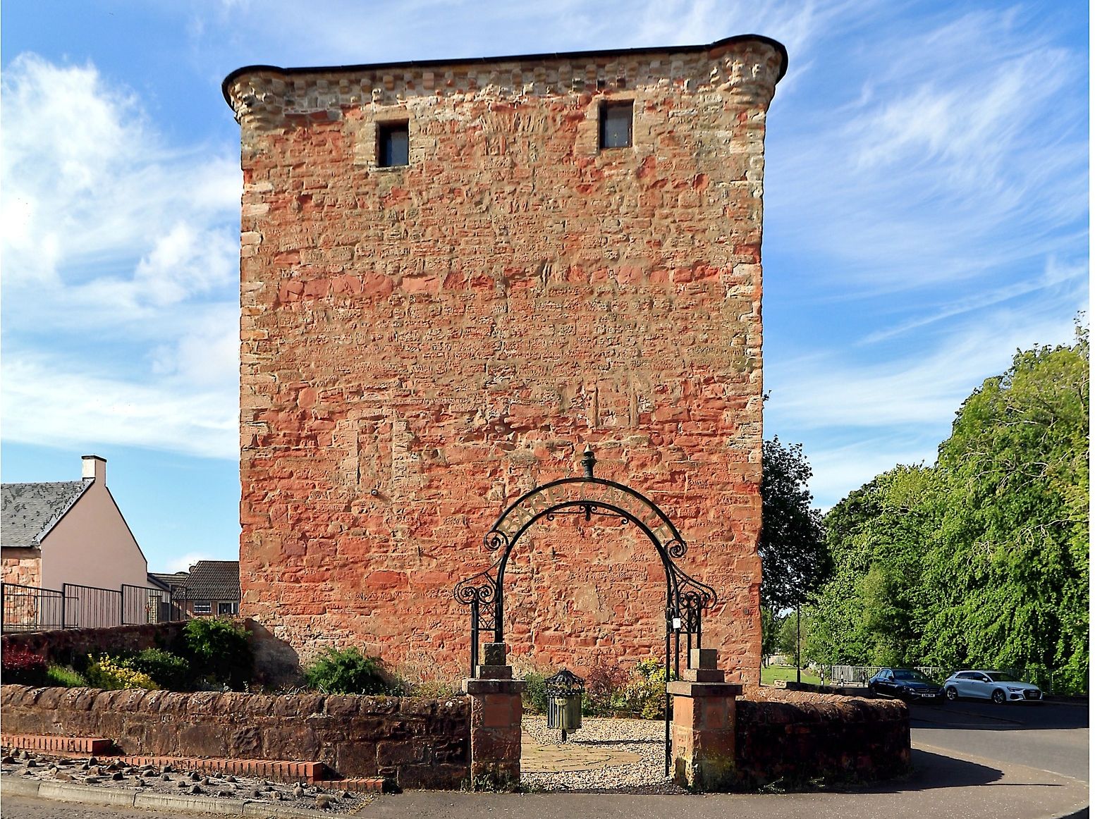
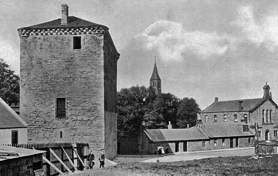
Barr Castle in Galston

Barr Castle in Galston

The five storeyed red sandstone tower castle
 
probably dates from the 15th century
 It was also known as Lockhart's Tower
and was built to control access points
 up the Irvine Valley


Barr Castle in Galston

Barr Castle in Galston


Barr Castle in Galston

Barr Castle in Galston


Barr Castle in Galston

Barr Castle in Galston


Balmoral Wool Shop in Galston

Balmoral Wool Shop in Galston


River Irvine at Galston

River Irvine at Galston


Galston Coop Building

Galston Coop Building


Bank of Scotland and Galston Coop Building

Bank of Scotland

and Galston Coop Building


Parish Church in Galston

Parish Church in Galston


Loudoun Castle at Galston

Loudoun Castle at Galston

a ruined 19th-century country house.
 

The ruins are a category A 
listed building


Loudoun Castle at Galston

Loudoun Castle at Galston


Galston History:
At the beginning of the 19th century Galston’s character and appearance began to change from a textile and agricultural centre to a major coal mining area.
The arrival of the railway from Kilmarnock in 1848 allowed new coal seams to open up.
Towards the end of the 19th century Galston had fifteen pits around the town employing around one thousand miners.
(a warren of disused mines lies far below the streets).
This brought wealth to the town allowing significant expansion and bound generations of the town’s people together.
The 20th Century saw the decline of mining locally and the last pit (Maxwood Pit) sadly closed in 1933.
The Goatfoot Colliery was situated where the Barrwood Gate housing development on the main road to Kilmarnock is now sited.
Deep coal mining was dangerous and treacherous, many lost their lives.


Location Map of Galston

Location Map of Galston


  Darvel & Newmilns Gallery Photo Gallery

<< BackScottish Cities : Next >>


Scotland Index :: Scotland Walks

Glencoe | Ben Nevis | Knoydart | Isle of Skye | Isle of Arran | The West Highland Way

The Eastern Highlands | The Central Highlands | The Southern Highlands | The NW Highlands


Adventure Travel : Worldwide Mountaineering : Site Index

fb icon  google+ icon Linkedin icon  twitter


Guide Books & Maps - Scotland:-


Western Scotland & the Western Isles OS Road Map Northern Scotland OS Road MapSouthern Scotland OS Road MapGlasgow Popular Hills - Map


Scotland - Lonely PlanetScotland's Highlands & Islands - Lonley Planet Scotland's Highlands & Islands - Rough Guide Highlands & Islands of Scotland - Hidden Places Rough Guide ScotlandScottish Highlands & Islands - Rough Guide Rough Guide: Scotland Lonely Planet, Walking in Scotland100 Hillwalks around Glasgow

Walking Through Scotland - From the Border to Cape Wrath Dumfries & Galloway - 25 Walks Scottish Borders - 25 WalksSt.Cuthbert's Way - Official Guide Southern Uplands WaySouthern Uplands WaySouthern Upland WayWalking the Southern Upland Way Across Scotland on Foot

Ochils and Campsie Fells  The Pentland Hills  The Border Country  Galloway Hills


Forth & Clyde Canal  Forth and Clyde Canal Exploring Edinburgh - Glasgow Canals 

Glasgow - A Portrait   Wee Book of Glasgow  Glasgow from the Air  Glasgow - No Mean City  Lost Glasgow  Glasgow - The Real Gorbals Story    

Glasgow Visitor Guide - Colin Baxter Itchy Insider's Guide to Glasgow Glasgow Footprint Pocket Guide Glasgow Insight Pocket Guide Glasgow Guide Pub Companion Glasgow Scotland's Highlands & Islands - Rough Guide Scotland - Rough Guide

Glasgow Insight Pocket GuideCollins Street Map of GlasgowGlasgow: Then & NowThey belonged to Glasgow Phillips Street Atlas of Glasgow & West Central Scotland Glasgow: The Photographic Atlas100 Hillwalks around Glasgow 50 Walks in Glasgow & SW Scotland

Visit Scotland - Touring Guide Scotland: Where to Stay - Hotels & Guest Houses Scotland: Where to Stay - Bed & Breakfast Rough Guide ScotlandScottish Highlands & Islands - Rough Guide Scotland - Lonely PlanetScotland's Highlands & Islands - Lonley Planet Great Glasgow StoriesGlasgow & Surroundings - Insight Guide

West Highland Way: Official GuideWest Highland Way: Rucksac ReadersWest Highland Way: TrailblazerThe West Highland WayWest Highland Way: Footprint MapWest Highland Way - Map West Highland Way - Map West Highland Way Wet Highland Way - Official Guide

Munro Almanac The High Mountains of Britain and Ireland The Munros: Scottish Mountaineering Club The Isle of Skye The Isle of Arran Wilderness Walks Ski Mountaineering in Scotland

More Wilderness Walks 50 Best Routes on Skye and Raasay Skye - W.A.PoucherMagic of the Munros Mountaineering in Scotland and Undiscovered Scotland by W.H.MurrayA Long Walk on the Isle of Skye

Classic Climbs - Central & Southern Highlands The Isle of Arran Lonely Planet, Walking in ScotlandPathfinder Guide: Skye and NW Highlands WalksPathfinder Guide: Fort William and Glen Coe Walks Rambler's Guide: Ben Nevis and Glen Coe50 Best Routes on Skye and Raasay - Chris Townsend


extremetracking


extremetracking

Google Analytics


Google Analytics

extremetracking
 eXTReMe Tracker


extremetracking
Sitelock caingram.com
SiteLock
Sitelock
Sitelock caingram.info
SiteLock
Sitelock